Sunday, August 2, 2015

The Long Road Back

We had planned for a very early start saturday morning.  Our flight back home was at 3:00, and we were a couple hours away from the airport.  Originally I had planned to do a little more sightseeing in either Dangriga or Hopkins however as the week went on, the girls had said they'd really like to find a way to visit the zoo.  Since the zoo was not too far from the airport, we figured we could wake up early, and get there shortly after opening time, walk around for a bit, and then catch our flight.

I don't think any of us slept entirely great. Before falling asleep the night before we had been visited
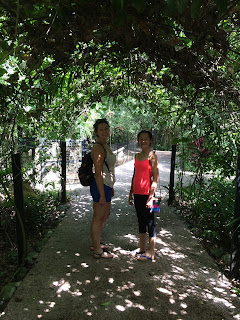
View from Our Room 
by 2 cockroaches an hour apart that were large enough to carry away a small dog.  While I think these were more a factor of the tropical location and the overgrown brush directly behind the hotel than any issue with hotel cleanliness, that coupled with what we had seen at the other hotel earlier that day played psychologically with our sensitivities to sounds in the room and feelings while we were trying to fall asleep.  So when our alarm rang at 5:45 we were both glad to wake up and move on with the day, but also still fairly tired.  We quickly packed up the car, and decided to take one quick look at the Dangriga Central Market which was only a few blocks away and opened at 6:00am before we hit the road. 
Dangriga Central Market

The market appeared to be more geared towards residents than tourists, with all sorts of things for sale from clothing to household goods to fruit and vegetables.  We grabbed a few bananas from one stall for our breakfast, and found another stall that had some colorful "Belize" handbags.  Kalyssa found a small shoulderbag that she wanted and asked how much it was.  The vendor asked another guy in the stall who said BZ$25.  (This would be US$12.50).  We said ok.  They called another guy over to take the money, and I handed him $25.  The two started talking in Spanish and it was clear this guy wasn't happy with the price the other guys had quoted us.  In Spanish he was saying "This should be $35, did you say $25?" The other guy answered in spanish, "Yes, I told them $25."  At this point he turned to us and made a last ditch effort, and in English said "He said this is $35?"  From listening to the argument earlier, my mind was still set to Spanish, and without thinking I said, "No, veinte y cinco."  This elicited a little bit of a guilty laugh from the other guy, as he realized I understood the small argument they were having in Spanish.  With this he accepted the $25.

We went back to our car, made a quick stop at an ATM to get the cash we'd need for the rest of the morning, and then headed out for our hour and a half ride to the zoo.  I pulled up google maps, which charted out a route taking me from the coast where we were, up the Hummingbird Highway back to the center of the country to come all the way out towards Belize City (which is on the coast) to go to the Zoo along the Western Highway.  Yet, I knew the Coastal Highway went straight from where we were to the zoo.  The distance in Google's suggested route was 140km, but if I clicked on the Coastal Highway route it was only 74 km.  Either route it said would take roughly 90 minutes.  This seemed really bizarre. 

I did some quick online checking about the coastal highway to see if there was any commentary about the road condition.  I found several other travellers that had asked the same question.  It appeared from comments that it was dirt/gravel the entire way, and that while the condition depended a lot on recent weather, it would definitely be bumpy no matter what. Comments absolutely warned that if you decide to travel it, to absolutely not do it at night.

Weather had been very dry all week with the exception of a few short showers, so I knew that would not be a concern.  I continued thinking about it as we headed to the split between the Hummingbird and Coastal Highways.  I stopped for gas right near the split and asked the attendant if he knew the current condition.  He said it is probably a little bit quicker of a route, but it is very bumpy, and you will need to go very slow at some points. He then continued, "But if you are feeling a little adventerous, maybe you will want to try that route." Hmm.

Well... I asked the girls what they thought, warning it would be bumpy.  They were indifferent.  So 
Belize's Coastal Highway

we decided to give it a try.  As soon as we turned on the highway it was gravel.  And bumpy.  It was the typical width of any highway here, plenty of room for two cars going opposite directions to pass each other (as long as they were staying in their theoretical lane).  The condition however would quickly go from smooth packed dirt and or gravel, to very rough gravel, back to smooth packed dirt, and then suddenly large potholes, and then smooth packed dirt again.   During the gravel parts, it felt as if we were in a massage chair.  After about 10 minutes we realized we had yet to see more than one car on this road. It was only 8:00am, but it was still amazingly abandoned.  The condition was consistently inconsistent for the next 20 minutes, changing from decent to very bad.  However for the next 20 minutes we still did not see a single car.  At some points there were smooth enough long straightways where you could see the road clearly well enough to get up to about 40 mph, but then others the condition would deteriorate and we'd drop to about 20mph.  Every now in then there would be a single lane bridge over a creek.

At one point a large sign said "diversion ahead"  at this point it appeared they were raising the road with the intention of building a large bridge, but there was also a path going away from this area along the creek.  It appeared that was where we were supposed to go.  So we followed the tire tracks around, and a couple hundred feet away from the main road was a small wooden bridge over the creek, and then the detour continued back to the main "highway." 
Bridge on "Diversion" from Main Route

Continuing further we now started hitting a few sections where the road narrowed quite a bit as it wound around through the tropical fields, and if a car came towards us, we'd both need to pull on the the shoulder to be able to pass. These were short sections though, and then it would open back up again.  There were a couple signs for small remote villiages off of this highway, but that was about it.  We did pass a couple people travelling on foot, and did eventually see 2 cars that passed us.  At one point the road narrowed quite a bit again, and came to about the saddest excuse for a bridge I'd ever seen.  It was wooden, and had two reinforced rows of wood in order for the weight of the car.  No side rail whatsoever. I stopped before crossing it and just started laughing.  Really?  It was about 8 feet above the creek, which was only a few inches deep.  We all held our breath and I practiced my steering precision to guide the car over the appropriate part of the bridge.  A large exhale of relief came out when we got to the other side.
Central Highway Bridge

Ultimately we did finally make it to the Coastal Highway's connection with the Western Highway,
which was about an eighth of a mile west of the zoo. We made it without incident, but it was one of those situations where afterwards, I knew that it wasn't the best choice of the day.  While if anything had happened to our car, we would have been fine (we had water, and there were travelers every half hour or so, and farms and villages around it) any kind of issue certainly would have taken many hours to get resolved and find a way out of the area. Given our flight was that afternoon, a vehicle issue probably would have meant we'd be stuck for another day.  Nonetheless it did make for a memorable adventure.

Before heading to the zoo, we figured we needed more to eat than bananas, so we headed over to Cheers, a restaurant we had eaten at earlier in the week, for a full breakfast.  As it was daylight now, we sat at the back of the restaurant looking over the Monkey Bay Wildlife Reserve.  While we waited for our breakfast, we watched hummingbirds flit around in the air and a pair of lizards battling it out in a tree next to our table. 
Breakfast at Cheers

After a meal of some of the thickest pancakes we've ever had, we drove less than a quarter of a mile over to the zoo.  We didn't know quite what to expect from a zoo in a tiny country such as Belize. The zoo actually was a by-product of a documentary in the 1980s called Path of the Raingods which Richard Foster (whom we stayed with and had breakfast with only a few days earlier) had filmed.  While still fairly small, the zoo was very well designed and actually bigger than we had anticipated.  All of the animals appeared to be rescued and rehabbed animals. There were many varieties of birds, jaguars, wild cats, and other animals to view.  It was here, and only here that I finally saw a tapir for the week.  The tapir exhibit explained further the impact of traffic along the western highway on tapirs in the wild, highlighting the number of accidents which had resulted in the deaths of wild tapirs.  To battle this problem, the "Tapir X-ing" signs that we had seen several times had been erected as well as more speed bumps. 
Tapir

It took us just under 2 hours to tour the whole zoo, and we then headed back to the car for the final 45
minute drive to the airport.  We arrived at about 12:30 for our 3:00 flight, which was about perfect timing for the chaos before us.  Though Belize is a tiny international airport, it was packed with people when we got there.  It was a long wait to turn in our car, a long wait to check in for our flight (the mission group of 14 from the night before were just ahead of us, as they were also on our flight), and a long wait to get through immigration.  This was just the beginning of a long series of lines and mass amounts of people that we would deal with for the rest of the afternoon and evening as we travelled through Dallas to get back to Nashville.


On the way back we reflected on the trip.  At one point after a long silence, Allie randomly said in amazement "We SCUBA dived in Belize this week!!."  Yes, we did... it did seem unreal.  We had spent 4 months planning for this trip, and in 9 days it was over.  I can't say the trip went perfectly, but it definitely went extremely well.  The weather was just about perfect, other than one night, our multiple places for lodging were just about perfect, and all of the activities were a hit.  I asked what everyone's favorite thing was that we did, and the answer was easily unanimous:  Actun Tunichil Mukal (ATM) the cave hike with all the Mayan artifacts and skeletons.

Earlier in the week, Allie made the comment that this would most likely be the last big family vacation with all of us as she's three years from graduating college.  She is probably right.  I said that it reminded me of the point in the chronicles of Narnia (I believe it was at the end of Prince Caspian) where it was said that it was the last adventure that Peter and Susan would have through Narnia as they had gotten too old and would be having there own different kind of adventures.  It was a great final adventure to have.  Our lives have all gone through several changes over the past few years, and will definitely have more major changes in the not too distant future where we move on to new phases of our lives.  However we'll still all be family, and will always have some sorts of adventures big or small to tackle together, and may years to look back and share the memories of some of these trips with each other, and with our kids and grandkids. That is something that no price can be placed on. 

As I was uploading this blog one night, I was thinking about the insanely vast amounts of data and content that get uploaded to the internet daily, and where and how all this is stored.  I did realize that all of these memories that I've chronicled in my blog over the last 7 years now are relying on some server at google to maintain, and these documented memories now rely on them continuing into the future.  Is it truly possible that this blog will still be available decades in the future for my grandkids and great grandkids to see?  I have no idea.  It would be great if it is, and hopefully they can learn a little bit about us and how much the world around us and the good people that live in it have to offer.

For those that have followed this blog, I thank you for sharing this trip with us.  God willing, there will be more chapters to add in the future.

-Ryan Ziemann, somewhere over western Tennessee


Friday, July 31, 2015

From the Mayan to the Musical


When I take international trips, I go to great trouble to create an hour by hour itinerary to act as a template for our days activities.  Sometimes, I follow that itinerary exactly.   Other times, I come across things that look more exciting than what I had planned, and I put away my binder (which is usually glued to my hand throughout the trip) and let the journey plan itself.  Other times, all the research and planning fails, and you suddenly have to enter crisis management mode.   Friday was one of those days.

We woke up friday with the sad realization that we'd be leaving our home for the last 3 days, Casa del Caballo Blanco as well as the town of San Ignacio.  Our stay could not have been more pleasant, and the company of Ricky the onsite manager, and Grace who fixed us amazing breakfasts and dinners everyday, all the while treating us like absolute royalty will truly be missed by each of us.  In addition to that, I will certainly miss the view outside our house that we had the privilege to wake up to every single morning.  Nonetheless, we had another cross-country drive ahead of us, from the western edge of the Cayo district to the Eastern Coast of the Stann Creek district.

We did not have a real tight schedule for the day.  We'd be travelling for over two hours (if we did not stop) to Nuuk Cheil cottages in Maya Center.  The Hummingbird Highway has a few various attractions along the way, and I figured we'd play it by ear as to what we stopped to see and what we passed up.  Originally I had planned to spend this afternoon and the next morning (before heading to the airport) exploring the towns of Dangriga and Hopkins.  Both are known for their music, specifically drumming, and their Garifuna culture.  (The Garifuna people originated in Belize from a couple slave ships which capsized and the would-be-slaves found their way to the shores of Belize.  The culture is very Carribean feeling, and the towns are very friendly, and very low crime places.). 
not stop) mostly along the picturesque Hummingbird Highway to get to the Stann Creek district area where we'd be staying at the

The night before,  Ricky had talked to me about a few things to see along the way.  The Blue Hole (a small inland one, nothing in comparison to the massive one off the coast, which we did not plan on seeing this trip due to the required cost and time commitment to see it), a tiny roadside stand that sold good tamales, and a strange section of the highway in the hills, where you can put your car in neutral, and it will apparently roll up hill.  (It is debated whether this is due to some magnetic force, or just an optical illusion.)  All 3 sounded like good reasons for a stop. 

Once we got to the city of Belmopan, and turned from the Western Highway to the Hummingbird Highway heading southeast we were definitely in for a visual treat.  The remainder of the drive was a winding road through small tropical mountains, all of which were covered in palm trees, and other tropical ground cover, and many of the homes, even those of the typical humble Belizean nature, had various beautiful tropical flowers, hedges, and flowering trees. Though it was obvious the vast majority of the residents did not have much financially, it seemed like a lovely area to live.
Hummingbird Highway

Twenty or thirty minutes later we came upon signs for the Blue Hole National Park.  We paid our entrance fee at the office, and were directed to drive another mile to the entrance for a very brief hike to the hole.  They welcomed us to swim, and there were changing rooms near the blue hole.  We hadn't intended on swimming, but thanked her anyway.  When we got to the parking area for the blue hole, a security guard told directed us which way to hike, somewhat apologizing that the Blue Hole was fairly brown this morning, but was clearing up, and was still fine to swim in if we wished.


We hiked for 2 or 3 minutes down a trail and a set of stairs to the blue hole.  Normally, blue holes are sinkholes that are full of water, but have a blue color due to the limestone in the water.  This one was a light tan with a bluish hint to it, likely from recent rains stiring up mud into it. The water sprung from under ground for the most part, but also had some runoff from the areas around it which had tainted the color for the time being.  The hole was only about 20 feet around, and connected to a short river of about 30 feet that then disappeared into a cave with a ceiling only 2 inches over the water's surface. There was also a "Hummingbird Loop" trail that was a mile long, but the girls were wearing sandles, and the terrain didn't seem suitable for their footwear, so we decided to jump back in the car and continue onward.

Blue Hole (not the "Big" one)
We were now on the lookout for both the area that Ricky discussed the "reversed gravity" effect.  He admittedly didn't have a good way to describe where it was, but I thought I knew roughly where he was referring to, and a couple times we stopped the vehicle in the middle of the highway, put it in neutral, but to our dismay, each time
we rolled down hill, not uphill. 

We also kept our eyes out for Bertha's tamales.  This he described as a small road side stand with a coke sign.  These are pretty common (though most either have a Bilikin beer sign, or a Crystal drinking water sign) so I feared this would be a challenge to find also.  However, as we came around a bend in the road, I saw a roadside stand with a coke
Bertha's Tamales
sign, and sure enough as I turned to look at the other side of the building as we passed by it said "Bertha's Tamales!"  I did a quick U-turn, and we headed back.  There were several vehicles stopped there. I asked what kind of tamales they had, and the young woman in her 20s answered "chicken."  We ordered three along with three soft drinks.  She asked if we wanted them here or to go.  And we said we'd eat them there.  She had some benches to sit on, so why not.  She opened up a Thermos cooler, and inside were dozens of aluminum foil individually wrapped tamales.  I grabbed the obligatory bottle of Marie Sharp's Habanero salsa and slathered some of that on also.  The tamales did come with chicken bones that had to be spit out (pretty much all chicken dishes here are "bone in"), but I thought they were quite tasty.  Allie and Kalyssa ate theirs, but weren't quite as impressed. 

We jumped back on the Humingbird highway for the final stretch to our destination.  I had counted my money and realized I needed an ATM to pay for our room.  So I figured we'd hit Dangriga quick, grab cash, and head to our cottage at Maya Center, drop off our bags, and head back to Dangriga for sightseeing and a 4:00pm reservation we had for an activity.  The driving distance between our cottage and Dangriga was unfortunately almost 40 minutes... further than I had hoped. Nonetheless, after we had cash in hand, we headed out that way.  We came upon Nuuk Cheil, and the sign for the grounds was certainly a bit rustic looking (hand painted plywood), but the grounds looked very pretty with paths, and tropical plants all over.  The office seemed a bit more questionable.  A young man appeared, and said the office manager was out at the moment, but he found our reservation in the book and us to our room.  Allie and Kalyssa were already very apprehensive after seeing the state of
Apprehensive Allie at Nuuk Cheil
the office, and some questionable pieces of ....furniture... sitting outside the office. (the bench seat from an old truck half chewed up by the stray dogs using it as a bed.)  Note, at the this point, while not entirely impressed, even our prior lodging at Casa del Caballo Blanco had a hand painted sign, and we were greeted by stray dogs along with the owner (Belize is overrun with strays, they are everywhere.)  He brought us to our room.  It certainly looked rundown, but at first glance, I thought it didn't look too much worse than the cabin in Lamanai.  The girls both looked at me and wrinkled their noses with the look of "really dad?"  I was somewhat in a hurry, as I wanted to see some of Dangriga before our 4:00 appointment.  The girls wanted to sit in the restaurant and use the wifi, so I told them, "go ahead" I'll get the bags quickly. 

I emptied the car and put all the bags in the room, and used the bathroom.  It certainly was extremely basic, and old, but didn't seem terribly dirty.

I went back into the bedroom however, and decided to inspect a couple black spots on the girls bed.  I looked closely at one, and it looked like guinea pig poop.  Hmm.  I thought perhaps its a weird fuzz.   I grabbed a piece of toilet paper and picked it up.  It was definitely poop. There were 3 pieces across the pillows, 2 pieces on the bed, and a pile of several pieces on the head board.

Now one note:  Belize is a tropical jungle.  There are bugs, and wildlife of all sorts.  One extremely common thing you'll see is lizards and geckos.  Geckos are great because they eat bugs.  They often get into you residences, and especially when staying in cabins and thatch roofed buildings as we have, you tend to see and hear them chirping in your living quarters.  This is good, because if a mosquito or two sneak in with you, the gecko will take care of it for you.  The downside is, they will occasionally poop.  A couple times I did find gecko poop on my bed at Casa Del Caballo Blanco.  However, it was very clear the bed spread and sheets were very freshly washed and it had just happened  (in fact they even changed the bed spreads again on day 3.) Also, there are mosquito nets, that would deflect any overnight deposits from on high as well as any mosqitos that snuck in the door with us.   There is a big difference between gecko poop and rodent poop however, and there is a big difference between geckos in your house or rodents.

I looked at the other bed, and while there was no poop, the bed had gray flecks of something all over the white sheets.  Dust? dirt? dead gnats? No idea? But as I was inspecting closely, I saw two tiny white spider/mites of some sort go running across the sheets.  I grabbed the luggage and began putting it back in the car. As soon as I was done, I pulled out my Lonely Planet guidebook to look for alternatives, preferably in Dangriga itself.  There were plenty of options, and I tried calling one, but the call wouldn't go through.  I figured we'd just drive to a couple on the way to our 4:00 and see what was available. 

I tried to find the young guy that had checked me in, but he was no where to be found.  Forget it.  I put the key on the bed, locked the door, and shot them an email explaining the room was unacceptable due to the rodent poop and we were staying elsewhere.

Allie read the Lonely Planet reviews on places in Dangriga, and we decided to go with the Jungle Huts.  Fortunately, this was right down the street from our 4:00 appointment.  I stopped the car and ran in, and quickly explained the situation to the owner and asked if he had any rooms.  He said he had a group of 14 that did take up most of the better rooms, but he did have some, and invited us to take a look.  He showed us a very clean looking room with very updated looking tile, and basic but nice beds.  He said the air conditioner should work (we haven't had AC since our first two nights).  I said it was great.  How much?  $89.  Love it.  "US dollar I assume."

"No, Belize Dollar."  My jaw dropped (that's $45US). 

"You are my favorite." I told him. He laughed. 

He asked how much the other place was (with the rodent poop).
"$60US!" I said, and he recoiled in disgust!

The girls also gave their nod of approval, and we unloaded our bags, and jumped in the car to head over to our next stop.
Jungle Huts Room

This area of Belize is known for being the musical center of the country.  If you know me, you know that my family is very artistic and musical.  Allie paints (and has one a first place and a second place ribbon in the Wilson County fair. Kalyssa plays drums (and pretty much any other instrument she can get her hands on), and I play guitar.  Within Dangriga is the Pen Cayetano Studio and Gallery.  Pen is Garifuna and plays the drums, was the founder of Punta Rock in the 80s, and is a painter.  His German wife Ingrid and their daughter are also artists.  They give tours of their studio and work, as well as drumming lessons. 

I didn't quite know what to expect when I got to the address.  Ingrid invited us in, and Pen scrambled turtle shell man wore in San Ignacio). Allie got a set of two drums, and he had one drum himself. 
to get his drums together.  Ingrid showed us around the art studio, which had dozens of paintings highlighting Garifuna culture and history, as well as Belizean history.  In a place of prominence she had an extremely old black and white photo of a black couple getting married.  She said the house was over 100 years old, and that was a picture of the original owners that they found in the attic when renovating it!  Wow!!! how cool! She then brought us downstairs and showed us some more art, as well as some more of Pen's instruments.  My eye caught two vintage juke boxes that were up against the walls.  Yes, Pen collected those too.  At this point, Pen was ready for us, and brought us out to his backyard where he had a stage and several Garifuna drums set up waiting for us.  He had us all sit in a circle, and gave me and his wife each a bass drum.  Pen gave Kalyssa a set of turtle shell drums (similar to what the Turtle Shell Man in San Ignacio played) and Allie another set of drums.

Pen introduced us to 4 different rhythms, showing us how it sounded, and then spending 4-5 minutes jamming on each rhythm with us.  The first one was very basic, and very simple.  The second one was a bit more complex.  The third one, I couldn't get my hands to do what I was telling them to, and kept tripping over my own fingers.  At one point, Pen leaned back with a hearty laugh, and stopped us and said "lets work on that one a bit."  After our 30 minute training session, Pen asked Kalyssa about her drumming and said he had a full drum kit.  He brought her to it, and gave her some sticks, and she played a bit for him.  I saw a bass hanging on the wall, and asked if I could use it, so I joined in.  Pen smiled broadly, and said "Hold on, I join you too."  He grabbed a guitar, and the 3 of us jammed away for 10 or 15 minutes. 


After we were done, Pen looked at Kalyssa and said, "That is great that you play drums.  It is always hard to find someone that knows how to play them, for some reason no one wants to learn drums.  You need to move to Belize and we start a band."

After this little session, Pen seemed reenergized.  With great excitement he began to show us the rest of his property including his mango trees, starfruit trees, chickens, a random rooster that has come to visit today, his outdoor kitchen, and his duck pond that has gone dry.  He picked up a couple fresh mangos and gave them to us to take with us.  We thanked Pen and Ingrid and all of us left with unrestrainable smiles on our faces.  That was a cool experience. 

There were a few other things I wanted to see here, but it was already well after 5:00, when most sightseeing places closed.  We drove the main street in the town several times looking for a place to eat.  The feeling in Dangriga was very different than San Ignacio, Orange Walk, or Belize City.  Ethnically, just about everyone here was Garifuna (roots come from Africa).  Everyone seemed extremely friendly, and when our eyes met with someones on the road we received a warm smile and a wave.  After several minutes of trying to navigate the narrow street, lots of cars, and people, and a bit of construction, I suggested we ditch the car at our hotel 3 blocks away and just walk over.  We did just that, meandered downtown. We found a Chinese restaurant called "Family Restaurant" and decided it was as good a place as any.  I had beef chop suey.  Nothing fabulous, but it was a change up from the cuisine the rest of the week. 

After dinner, we took a brief walk to the Stann Creek, and followed it over to the ocean through the area of the Dangriga Central Market.  This was closing up for the night, and it looked like we wouldn't get a chance to actually shop in it, as the current plan was to get up super early and head up to the zoo for a few hours before heading to the airport.  At this point it was getting dark, and we decided to start the walk back to the hotel. 
Stann Creek to the Ocean

Stann Creek Inland


As has been the drill every night, the girls wound down in the room, while I worked on the blog at the outdoor restaurant outside the rooms.  A while later, I received frantic texts from the girls that a large cockroach was in the room, and I needed to come kill it.  Belize has the same large flying cockroaches that many tropical places have, and apparently one found its way into our room.  So I took a break from my blogging to exterminate the invader (finding both girls standing in fear on the beds) and returned to the restaurant area.

While sitting outside, the group of 14 showed up.  It was a group of Methodists from Texas (and a couple from New Jersey) that had been in Belize for the past week for a mission trip helping set up an eye clinic in Punta Gorda (one of the few areas of the country that we didn't get to visit.)  It was nice hearing the talk about all the things they were thankful for from the trip.  Many of them were likely late teens, and had never been to a place like this.  As I've always heard from Mission trips, those that come to be servants and help with projects for the locals end up walking away feeling like they benefited as much if not more from their interactions with the people here than those they came to serve.  Several of them shared stories about the interactions they had, and what they will remember the most about the trip.  Although I could only hear part of the story, one of them talked about how she got to see a young girl looking through corrective lenses for the first time.  It made me think of a viral video I just saw on facebook a few days ago of an infant seeing her parents clearly for the first time, and the look of amazement and joy on the baby's face.  Yeah, that would definitely be fulfilling. 

There is so much value in bridging borders and making connections with people whom you thought you'd never have anything in common.  You often walk away realizing you have more in common than not in common.  Relative American wealth, comfortable living conditions (water, air conditioning, etc.) are all secondary to the things that really matter in building connections with our fellow man such as family, community, and sharing the positive energy of the human spirit with those around you.  There is so much of that to be shared, and it is something that reproduces easily the more you share it. 

I am happy to be returning back home tomorrow (as I do miss air conditioning, and not sweating through my clothes every day by 10:00am), but am also sad for the week to be over.  We have had some great experiences, met some great people, and seen some unbelievable sites.  I had many classes in high school and elementary school on the Mayans, but I learned more in this week and will retain it better than all the cumulative Latin American history I learned in school.


Thursday, July 30, 2015

Mayans: From the Ancient to the Modern

Thursday morning we'd given ourselves a little bit more time to sleep.  We've been on a very hectic schedule since we've been here, and have been waking up very early most morning.  Since today most of our activities were within 30 minutes of the house we were staying in, and we had a fairly leisurely schedule, that there was no reason to rush things  We woke up around 8:00am and walked over for breakfast.  As every meal has been so far, it was a huge meal and all very good.  Afterwards the girls showered, and we headed out for today's first site.  X'unantunich.  This is an impressive Mayan sight only a few miles from our guest house, and only a few miles from the Guatemalan border. 

Looking at my Google Maps, it looked like the most direct route was to cut through from the road our guest house was on to the Western Highway on the first road of central San Ignacio.  As I came up to this road, it was a very rough dirt road.  I didn't have to go too far on it, so I thought why not.  Well as we began driving down it bouncing around through potholes and rocks, carefully trying to not destry our SUV and careful to not get stuck in a hole.  The dirt road was looking less and less like a road the further we went.  We were getting close to the junction with Western Highway, and I figured if google maps says it connects, and has it listed as any old road, we should be able to make it.  We could now see Western Highway somewhat along side us, and our road would eventually merge onto it, but currently we were separated by a large drainage culvert.  All of a sudden however, the road in front of me dipped a bit, and there was a huge mess of dried up mud where clearly a large vehicle (or many at different times) had gotten stuck.  There were very deep ruts, with large ridges in the middle of the road.  I was fairly certain that would not be passable in our little SUV.  I stopped the car, and just said, thoughtfully, "Huh."

As I sat thinking for a bit, I noticed there was another path that had been carved going around this mess and a tree.  However that new path also had a bit of a deep hole, and the path around that was at a very steep angle that made me worry about tipping the car over.  I didn't want that to happen either.  As I sat contemplating it, I figured we could somewhat split the difference with the hole and the angled path, and try and go through quickly.  Allie and Kalyssa started chanting a little cheer of some sort, I hit the gas, an we made it to the other side!  From here it was a straight shot back to the main highway.  This did leave me somewhat amazed at Google maps and the fact that in countries like this where "road" is a very relative term, that a "road" such as this is still able to be mapped and stored in its database.

While we had successfully made it passed this challenge, my guide book had me somewhat curious as to how the next step was going to work, as it said we needed to cross a "free hand-crank ferry".  Well, that was a new one to me. 

As we got near the point where we'd be getting on the ferry, we suddenly noticed a large bus along
the side of the road a long line of people, and a few cars, all in front of several tents of souvenir vendors.  As I passed a couple of the cars, I realized they were probably in line for the ferry, and that I needed to go back and get in line.  There was a man with a lanyard and some sort of ID card hanging from his neck, so I figured he must be someone official, and rolled down my window to talk to him.  He confirmed, I needed to get back in line, and said, don't worry, there is a cruise ship crowd in front of you, the mosquitos will all be full.


The Hand Crank Ferry
Ugh.  In talking to some of the guides, they had said that this is the off season in Belize, due to the risk of hurricanes, and relatively rainy weather.  They said over the winter, that sometimes there could be as many as 5 cruise ships docked in town with thousands of people coming out for some of the most popular tours. I was really excited to not be here during that time, as most of the sites we've been to have been virtually empty. Today would clearly not be the case.

I turned around and pulled my car in the back of the line.  The girls wanted to shop at the souvenir stands, so I stayed with the car while they browsed. After about 10 minutes it was my turn to get on the ferry (it held up to 4 cars at once).  I was a little caught off guard as I didn't realize I was close enough to be in the next group that boarded.  The men manning the very began to beckon to me to pull onto the ferry, meanwhile, I had to find the girls.  I quick jumped out of the car and looked around and couldn't see them.  I called loudly but blindly hoping they'd here, and sure enough their heads popped out of one of the stalls.  They couldn't ride across in the car, so they followed me as I pulled on, and after boarding, one Belizean started cranking away at a large handle, and we slowly floated over the river. 

Once on the other side, the girls jumped in the car, and we drove up to the parking lot, and then walked into the park.  There was a short uphill hike and as we were walking up, there was what appeared to be a mound of dirt along the side of the road with a small canopy over it.  Underneath, was a single person with a shovel.  He was excavating another structure in the ruins complex!  How cool. 

We hiked further up the hill and turned a corner and were suddenly in the main complex.  The highest temple of X'unantunich (which means Stone Woman) called El Castillo was directly in front of us it was absolutely immense.  There was a long line of people climbing it and on top were tiny little dots that were people that had complted there ascent.  This temple was by far the tallest of any we'd been
to yet, at over 40 meters! (130 feet).  Just as exciting was that the long structure to our left, was littered with canopies, archeologists and excavators working on it right in front of us!  Different parts of the structure where in various stages of excavation and all around were excavation tools, piles of rock that had been removed and would be replaced once restored, sifting tables etc.  It was really cool to see.  One group was shoveling out disintegrated limestone morter with a spade.  You could hear the spade hitting rock as it was shoveling the limestone dust.  Allie commented that the process was making her so tense that she wanted to go over and ask him to please be very careful with the priceless ruin. 

Since El Castillo was overrun with cruise ship tourists we decided to tour some of the other structures in the complex and went opposite of El Castillo to the Royal dwelling.  This was a much lower building, but still awe inspiring.  The information center we walked through before the hike explained that this area was initially settled in 3000BC, and continued until around 900AD.  Most of the buildings that we would see were from 200-900 AD.  As subsequent generations of Mayans grew their temples taller, they would do so using the older structures as the foundations for the newer ones.  As we came around a corner of the royal residence, there was a group of about 6 tourists listening to their tourguide talk about the complex.  As I walked by, the tourguide glanced our way, and our eyes met---it was Ricky, the onsite manager of our guest house!!!!  We both kind of smiled and laughed, and I went over and said hello quickly, so as to not interrupt his tour.  That was a very unexpected encounter! 

El Castillo at Xunantunich
At this point it looked like El Castillo was clearing out a bit from the cruise ship tourists.  We started to make our way over there.  The girls asked me if I planned on climbing this one.  ...."Duh....of course!  Go big or go home!"  They said they'd wait at the bottom for me.  I attempted to make a quick ascent, however, there was now a long line of the cruise ship crowd descending, and I had to wait for them to clear a path for me.  Finally, there was room that I could use one of the staircases up the back of the higher section of the temple.  From the top of the temple, as expected, the view was spectacular. 


Atop El Castillo
I took it in for a few minutes and then quickly descended. 

Street packed with Cars for Benny's
We made our way back to the car, and crossed the ferry to the other side of the river.  After doing a little more shopping in the stalls we checked our guide book for a good place to eat, and it recommended Benny's Kitchen.  A sign on the main road right across from the ferry directed us down a side street to get to Benny's.  Ultimately, there were several twists and turns on dirt roads throughout the residential area before we found Benny's.  From all the other buildings around, I was starting to think we may be having lunch in the home of some guy named Benny, in his kitchen.  However as we approached the restaurant, the entire dirt road, barely big enough for two cars to pass was lined with parked cars.  Behind them all was what appeared to be a pretty crowded restaurant. 

We grabbed a table, and looked at the menu.  The special for the day was something called Pibil.  This was a pork dish cooked underground that was seasoned and had rice and pico de gallo as a side, served with tortillas.  Allie and I both ordered that one.   While we were deciding, I looked up, and who walks in? None other than Ricky and his tour group.  We called to get his attention and we again smiled and waved.  After getting them situated and ordering, he came over to sit and talk with us.  He asked what we ordered, and I told him that Allie and I were having the Pibil.  He said that it was absolutely excellent, and explained how it is slow roasted in the ground over night.  I told him it sounded very similar to traditional pulled pork in the south.  When the meal came, it definitely reminded me of some good old smoked pork in the south....but with a little bit of a Hispanic flair to it. Regardless, it was tremendously tasty.

The four of us talked a lot about the various temples that we'd seen so far and Mayan civilization, pretty much picking up where he and I had left off the night before.  One of the interesting things he told us was that the Mayans didn't base their sites solely on water sources.  Instead many of them were further away from water than they needed to be, but they used dowsing rods to determine where the appropriate site should be built.   Very interesting.

We rushed to finish up lunch, as our next appointment was only about 4 miles away, but we only had 10 minutes to get there. All through lunch we'd been hearing thunder in the distance.  It still had not rained on us, but the sky did look a bit unhappy.  Our next site was a place called the Poustinia Land Art park.  This was not an ancient site, but an outdoor art exhibit of some sort.  Its location was some what obscure, a couple miles outside of Benque Viejo del Carmen.  I had called the day before to make an appointment and was given directions, and my guidebook as well provided a decent summary how to get there.  It included travelling a poorly maintained gravel road (which is most of Belize, so that wasn't too surprising) for 2.5 miles.  However, it did seem this dirt road was just over grown getting narrower, and not getting anywhere in particular.  Suddenly however I did see a small sign on a dirt "driveway" that said Poustinia.  As luck would have it as soon as I pulled in, it started pouring rain.  We drove aways down the driveway about half a mile, and found a covered picnic spot with a couple men standing there.  I asked one if he was there to meet me (as when I made the appointment they said someone would be meeting me.)  He seemed somewhat confused, so I go the impression the answer was no.  He said someone had been there earlier but they left because of the rain. I thought about it for a few moments, and figured even if it did stop raining, it sounded like this would have been a very muddy and buggy hike through the park, so I figured we'd skip it and move on to our next activity.
San Ignacio Building (on the way to Sak Tunich)

From here we about a 15 mile drive to go to an obscure site called Sak-Tunich.  Ricky had told me about this place the night before.  It is a family that really loves their Mayan ancestry and 25 years
ago decided to attempt to recreate a Mayan temple on their property.  They did such a good job, that at some point the Belizean government and archeologists took notice, that there were ancient ruins on their land and demanded they register it as an ancient Mayan temple.  The owner's had to convince the government and experts that no, this wasn't ancient they were building it!  Ultimately the were able to convince them. 

My guide book had a reference to this place on a map, but no explanation at all of what it was.  I did a little bit of internet research, and was able to contact them via Facebook to find their hours (they responded within seconds).  We headed over that way. This site is on what appears from maps to be a fairly main road between two Belizean towns: Cristo Rey and San Antonio.  Once we turned onto this road however, the entire thing was gravel and seemed like it was snaking through almost entirely residential areas, with the exception of a couple resorts.  We did see quite a few attractive neighborhoods as we travelled this street, and the road was extremely hilly in this part of Belize, which certainly kept me attentive.  At one point I was coming around a bend, as was a large oncoming truck.  As soon as I saw the truck though, I also realized we were both about to go over a small bridge over a creek.  There was only a raised edge of the bridge that was 3-4 inches high, and then a drop of 6-8 feet into a small ravine.  I suddenly had the split second realization that I had extremely little room to spare on my side, very little room to spare due to the oncoming truck, and that we were both timed to perfectly hit the bridge at the same time, and no time to slam on the breaks.  It was one of those do your best to stay on the road and not hit the vehicle, and hope that it is possible to do both, AND you're able to achieve it.  I did this, though not without making a very nervous "meeaahhhhhhh" sound. Which then was echoed by the girls as we all saw the very tight squeeze ahead of us.  Fortunately both vehicles made it across and neither touched the other.

Sak Tunich

We continued quite aways down this road and at a very slow pace.  We finally came up to the Sak-Tunich, which was impossible to miss as it was right up against the road.  It certainly did look like an ancient temple, carved into the mountainside.  We got out and immediately the owner's son, who was Allie's age came out to greet us.  He offered a tour, and we spent 20 minutes or so seeing the alters, stelas and other carvings all around this temple that was all 25 years old or younger.  He then showed us one of the newer sections of the temple.  His dad at one point was building a cubby hole to display some artifacts, and decided why not just keep digging and see if we can build a tunnel into the limestone.  This tunnel enters about 6-8 feet, and then takes a 90 degree right turn and continues another 10-15 feet.  Just amazing.


After the tunnel tour, our guide asked if we were interested in hiking or driving up to the lookout tower.  (I had completely forgotten, but Ricky had told me about this too.)  I said we'd definitely be interested.  So he brought us over to his truck, and we started a slow ascent up to the top of the large mill/mountain across the street from Sak Tunich.  We weaved back and forth and around  through a small path in the jungle at about 5 -10 miles per hour, and after 10 minutes or so arrived at the top.  We got out, and I saw a square metal tower with stairs that simply went up and up and up forever.  Ugh.  I'm afraid of heights.  And here I've got to trust some structure on the top of a hill in the middle of nowhere.  The construction certainly looked strong enough, and seemed to be engineered solidly, none the less... as I said I'm afraid of heights, and this thing had to be 6-8 stories high.

The girls of course simply wanted to get to the top.  As we started ascending, I kept my eyes on the bottom of the platform above me, thinking we're almost there its not that far.  Finally we reached it.  I realized we weren't in the open air yet, looked up, and realized, there was still another 3-4 stories that we had to climb to get to the TOP platform... Uggh.  When I got up there, my knees were weak.  However, the view was unparalleled even against the views from the Mayan temples, as we were much higher than any of those by far.  Our guide brought up binoculars for us to look at a few things in the distance.  There was a Macaw in a tree a few hundred feet away, and quite a distance lower than us.  All of a sudden on the other side of us was a very bizarre bird sound that I was not familiar with.  One of us asked, "what is that?"  "Oh, those are just parrots." 

Atop the Tall Tower
The sounds were echoing through the hilltops, and we couldn't see where they were coming from , but there were clearly a lot.  It sounded as if they were getting closer, and we sat transfixed waiting to see what a flock of parrots looks like.  Finally they emerged, and it was 30-50 parrots flying in a flock.  From the distance all we could see was that they were green, but nonetheless what a sight to see, as that many parrots flying together in the wild.

At this point, while I appreciated the sites, I was about done with the heights, and we descended the tower. 

After a little bit of time in the gift shop (where our guide's father had carved all the items), we got in the car, and made our way back to Casa del Caballo Blanco


Bananas FlambĂ© with Ice Cream 
We got there just in time to freshen up for dinner, and have ourselves another huge meal.  After dinner was done the girls were stuffed, and got up to leave.  I called them back and said, "I believe
dessert is still coming."  "Ooohhhhh."  They sat down, and almost immediately, Grace, the cook, brought out Banana flambĂ© for each of us.  Allie looked at it, took a taste, and had a sudden look of shock and delight on her face.  She then described it to us as "Its warm bananas and ice cream in a pool of yumminess!"  Somehow we were even able to shove this into our stomachs, and left very full and satisfied for the night, both from the food, as well as from viewing 5 millennia of Mayan creations, all in one day.

Journey through the Portal to Hell

I will apologize, today's post will be light on pictures.  The explanation of why will come later....

Wednesday morning, we finally got to see what Casa del Caballo Blanco and grounds looked like in the
daylight.  We woke up and got ourselves put together to go have breakfast.  Walking out of our room we were able to see how spectacular the grounds around us looked.  Outside our room were walkways with all sorts of tropical plants, and a huge grassy field that sloped down into the valley with palm trees dotted throughout and lined with various other trees at the far end of it.  A mystical fog hung over the trees at the far end, making it feel like we were alone in our own little sanctuary in Belize.

View from Outside Our House
We walked over to the large public house, and walked in.  But no one was there.  Hmm.  I had told them we'd be down for breakfast at 7:00.  So we waited for a few minutes.  Kalyssa asked me if I was sure I was in the right place.  A little irritated, I said "Yes I'm sure, I was just here with Ricky (the manager) last night.  And that is why this room is full of tables. "  Meanwhile Allie decided to go for a little walk while we were waiting, and came back a couple minutes later saying "Yep, we're in the wrong place, the dining room is over there."

Oops.  So we walked a little further down the path, and into the dining room.  It looked like Spanish royalty were expected.  We sat down at the 3 place settings, and very quickly a Belizean woman came out of the kitchen with overflowing plates of fresh fruit.  After the fruit she brought out bacon, refried beans, fresh squeezed lemonade, eggs, and little oval ring type things that she said were similar to croissants.  (This morning I skipped the eggs.)
Walking to Breakfast

The Dining Room

We ate our breakfast, and as we were almost done, she came out and talked to us a little bit. We are the only guests currently, though they had a few that left right before we got here.  She mentioned that the girls reminded her of her own, as her's where the same ages.  We didn't get to socialize too much, as we had to go pack our bags for our tour today.  The plan for the whole day was a tour of Achtun Tunichil Muknal, (more commonly referred to as ATM).  This tour warned that it was a strenuous hike, that hikers were required to be able to swim and that a change of clothes was required as well as socks, because part of the hike is done without shoes. Many people that I have talked to since getting here had said this is a "must do".  Fortunately so did my guidebook and Trip Advisor.

A large conversion van picked us up, and warned us that he had to pick up our tour guide, as well as another couple that would be joining us on the tour, and then it was a long drive to ATM.  He said we'd probably be in the van for an hour and a half or so. 

This did give us a chance to see some of the countryside in Western Belize (known as the Cayo District).  This part of the country was much more hilly than the Northern and Eastern parts of the country we've been in so far, and is similar to what I'm used to in the Nashville area in terms of topography.  Except there are palm trees here... we don't have those in Nashville.

The final 7 miles were down a dirt road only big enough for one car.  We passed through several farms of mahogany, Valencia oranges, corn, and other crops.  The condition of the road was fairly terrible, and we couldn't go much over 20 mph the entire way.  After 30-40 minutes we finally made it to the parking area where the hike was to begin.  Jameel, our guide, told us we should leave everything in the car, except for the socks we needed, as nothing else is allowed into ATM.  He did give us each a bottle of water, but even that he said we would be required to leave at the cave opening.  Unfortunately cameras were not allowed into the cave, ever since an issue that occurred in 2012.
Achtun Tunichil Mukal Hike Begins

The hike consisted of a 30 minute hike through the jungle.  As we entered the jungle he told us "Just about everything in the jungle has some sort of self defense.  It is best if you do not touch anything.  He specifically pointed out a few plants that had adapted some self defense mechanisms, including a bamboo plant that had large thorns with a stinger on the end that looked like a scorpions stinger.  Not to mention the jungle is also full of jaguars, tapir, and howler monkeys.  (Occasionally we could hear the howler monkey's faintly in the distance.)  The hike did require us to cross the river back and forth 3 times.  The first time we did this, the water was waste deep, and a little cool.

As we got to the mouth of the cave, a deep pool of water led into it.  We stood next to this pool that emptied into the river outside, as Jameel told us the story of ATM.  The cave was re-found in1989 by a spelunker named Thomas Miller who was simply looking to explore and map caves in Belize. When he entered into this one, he quickly realized this was not just an ordinary cave, as only a couple hundred meters inside, Mayan pottery could be found strewn about everywhere.  Subsequent research on the cave by archeologists determined that this was a place that high priests would use for human sacrifice and blood letting ceremonies between 200 and 900AD.  Before entering, the high priests would drink alcohol, consume mushrooms, and inebriate themselves with poisoned toads (they were aware that the toads destroyed the liver, so they found away to consume them without eating them that fixed that problem....yes, that is where they stuck them.)  Jameel did apologize that today's tour would not be offering the full high priest experience, (but maybe for $500 more....).  The ancient priests considered the cave to be the entryway into Xibalba, which meant "place of fear" and was where the gods of the underworld dwelt.  It is also known that when the group was leaving the cave there were always less people than the number that went into the cave to start.

The cave has been left almost entirely as it was found.  No excavation, and only a few items were removed to be studied/carbon dated, and then returned back to the cave where they were found. 

Jameel explained that we will certainly be actually walking on Mayan artifacts even though we won't realize it, as all of the flowstone and calcification that occurs naturally in the cave has consumed much of it, and there is so much that had been broken that there are pieces everywhere.

After the history, we all turned on the lights on our helmets and jumped into the pool and swam the first 20 feet into the cave.  After that point, we hiked for 500 meters, continuously in water that was sometimes only ankle deep, and other times shoulder deep. The terrain was sometimes course sand, and other times large boulders.  Shortly after the enterance was a large, fairly round boulder, similar in size to the one in Indiana Jones and the Temple of Doom.  I couldn't see where it connected to the roof, and I was envisioning at some point it would release and start chasing us out of the cave.  As we got deeper we began to see some huge limestone and quarts formations all over the walls that I could certainly envision the Mayan Priests, stoned out of their mind, seeing these huge formations and considering them the chandeliers and wall hangings of the gods from Xibalba.  Most of the caves during the water part of the hike where fairly spacious:  20-30 feet high if not more.  A few points it narrowed to a size though where you had to twist in strange ways to get through.

The one part that certainly provided anyone with a bit of discomfort was while waist deep in water, there was a very narrow break between two rocks.  A flat horizontal chunk of rock jutted out with a bit more room over it, and some room under it.  Jameer showed us how to get through by angling one shoulder down, putting your chin over the flat piece of rock, and sliding through.  It looked slightly uncomfortable, but he made it easy.  When you tried it yourself however, you realized, that you are positioning yourself, looking at this piece of rock aimed right at your jugular, and you are intentionally wedging your body through this space.  This unease spikes dramatically when as you are doing so, you realize that the space is just narrower than the width of a normal human neck, and the "blade" of the rock glides across your throat as you move your body through the crevice, covering your body in a cold chill at the reality of what you are doing.

Eventually, we got to the end of the water part of the hike.  We had to climb up some rocks to a platform, and ascend further in the cave.  At this point, Jameer asked us to remove our shoes, and leave them by the piles of shoes left by other travelers.  He had our socks in a water proof bag, and handed them to us.  The purpose of this was to protect the site as much as possible both from the heavy tread of shoes, and from the oils from our skin. 

From this point on, there were broken vessels everywhere.  (The vessels were broken as part of the rituals performed in here.)  Most were starting to be consumed by the cave and were partially buried in the floor of the cave.  Areas that clearly had vessels or other artifiacts had strips of orange ducttape on the ground to indicate not to cross into that area.  But as you walked, your toes were literally going inches from all these ancient items.  At one point, there was a clay pot that Jameer pointed out, had an insignia on it in the shape of a monkey.  This item was one of only 4 that have been found anywhere with that matching insignia.  This was just amazing. 

The caverns that we were traversing now were increasing in size.  Some had to have ceilings that were 60-70 feet high.  Absolutely huge, with stunning flowstone formations all over.  One very large curtain of stalactites draped all the way down to where we were.  Jameer showed how knocking on them, they actually have a surprising musical sound like a xylophone, and each one plays a different note.  Further into the cave, there was a skull of a teenage boy lying on (partially in)  the floor.  Again, we were close enough to touch it (which of course we did not). 15 feet further was a pile of several bones including a skull, part of a spine, a femur all piled up.  (one theory is that the body was initially left further up, but a flood washed the bones down later into a pile)

Ahead of us though were two of the most amazing remains.  In a much smaller room, that the 6 of us barely fit in was a skeleton.  This was also a youth, but one that was deformed (either through illness or intentional skull modification during development) with a very large forehead and cranium.  This body had its arms tied behind its back.  In looking at the skeleton, it looked as if he had been bludgeoned in the forehead, as there was a 1 inch by 2 inch whole in the skull.  And perhaps stabbed as well, as there was a one inch round hole in the temple. 

Sameer asked what we thought caused the hole in the skull.  A rock?  (he had earlier said that was a common mode of sacrifice.)  His answer was "No, this hole was caused by a Sony Camera in 2012."  A tourist was attempting to take a close picture of this skull and dropped his camera.  That small round hole is where another tourist put their hand on the wall to lean forward and take a picture, and knocked a small rock loose, that created that hole.  This is why people are no longer able to bring cameras into ATM.

I sensed everyone shared the same sense of disgust, that all of these artifacts that have been here for over 1000 years, had been discovered and open to the public for only the last 12 or so, and already two people have done more damage than nature has in the last 1000.

Behind this skeleton in an attached adjoining room was the most impressive skeleton.  One that has been debated back and forth if it was a girl or a boy, but the skeleton was lying in a bit of a "dancing" pose, its bones calcified into a sparkling white.  It is unknown if the body sprawled into this pose after being killed or was intentionally placed into this pose. 

There was certainly an eerie, evil feeling about this whole place, that saw such brutal murders of babies, children, adults... all to try to make gods happy that the Mayans thought must have been mad at them due to hurricanes and droughts and other disasters that fell before them, and the bodies of those left to get consumed by the cave over the next 1000 years. 

A few images of some of the pottery as well as the Crystal Maiden can be seen here. Or of course a google images search will provide all sorts of pictures that I wasn't able to take.

After reaching this point, we turned around and retraced our steps to the entrance of the cave, at a much quicker pace.  As we got to the deep pool at the mouth of the cave, there was another cave guide donning a snorkel mask.  He emerged from the cave with us.  It turns out another tourist had entered the cave and lost his wedding ring in the first pool.  The guide was able to dive to the bottom and found it.  I sure hope THAT guide received a good trip for his extra efforts!

This guide joined us for the walk back to where our van was, and it was interesting to hear a spirited discussion between him and our guide about Mayan dialects, and debates over items found in certain Mayan historical sites.

As we emerged from the jungle, we saw that several plastic storage containers were lying on the table
awaiting us to eat for lunch.  Our guide also was kind enough to pull out some Belikin Beers for each of the adult travelers.  We were surprised to see that it was already 2:30, and we were all absolutely starving.  We all ate the traditional Belizean meals (stewed chicken, rice and beans, and a slice of fried banana) incredibly quickly and boarded the bus back to the guest house. I was now regretting that I had told them we'd be back for dinner at 5:00, as I was a bit worried we'd now not be hungry.

We arrived at our guest house shortly after 4:00, and talked a bit about the plans for the rest of the week.  I mentioned that we would be staying at a Mayan Guest house later in the week.  In a fairly "blonde" moment, Allie asked: "What is a Mayan Guest House....Is that like the Amish for Latinos?"  This brought Kalyssa and I almost to tears with laughter. 
Afternoon view of Guatemala from our Guest House


We freshened up and made our way over to the dining room for dinner, and had another feast of tomato soup, avocado and cucumber salad, stewed chicken, and mashed potatoes followed by casaba pudding.  It was all very good, and we surprised ourselves by eating just about all of it.  We also had a bit more time to relax and talk to the woman who took care of all the meals, sharing stories of my girls getting into trouble and injuring themselves as they grew up, and our hosts stories about her daughters, as well as her and her sister.  A great end to a great day.
Afternoon view of San Ignacio from our Guest House

After dinner, we did decide to get a little adventurous and go look for a night market in town to do some shopping. We had seen one when we drove in, but as we went out and walked around, many of the shops were closed, and no more tables set up with things for sale.
Shopping in San Ignacio

We did however get introduced to "the turtle man" who probably received the best tip he's ever gotten for 25 seconds of performance, and one picture, only because I had already pulled out my wallet, and I had a limited supply of the appropriate bills to tip him with.
The Turtle Man

After only a short time in town, we returned to our lodge.  The girls retired to bed, and I went to the meeting room to blog.   While I was working on it, Ricky came by and we started talking about our experiences today.  He added some fascinating stories about the area saying that there are countless other Mayan sites that may be as impressive as ATM.  Someone he knew had a dog that climbed into  small hole.  From the dogs barking, it was clear there was some sort of a cave.  They pulled out some pick axes and found caves with shelves of huge Mayan jars.  He also said that he would go on camping trips many months at a time when he was younger along the Belize/Guatemala border and found many sites that were yet to be charted.  We also discussed the cycle of the rise and fall of civilizations such as the Mayans in Belize, which peaked at over 1 million people, resulting in over farming and over deforestation ultimately making the land unlivable, and causing their reign over the area to end.

Much of the learnings this week about the rise and fall of the Mayan civilization draws many parallels to the Angkor civilization, whose ruins we explored only 3 years ago.  Both groups ascended to tremendous power but then both societies ultimately crumbled.  It does make me wonder if we've learned enough about the fall of great civilizations that today's great civilizations are immune from such issues? Or in 1000 years will people be touring the ancient ruins of the great cities of the 21st century.  Sounds far-fetched.... but look at the path Detroit has led: a population of 1.8M in 1950 is now 700k. Those that know me, know I've held strong concerns and opinions about the future of Chicago and that it is following in the footsteps of Detroit.  Both are cities that have dealt with financial mismanagement for decades and now are collapsing under their own weight. They are not the only cities.  Could an entire superpower country of 300+ million people have the same fate?  "Those who do not learn history are doomed to repeat it."

My question is.... have we?